Entries in day trip (9)

Thursday
Dec222011

Munich Day Trip - Salzburg (Austria)

Another city that is sooooo close to Munich is Salzburg, Austria, perfect for a Saturday trip:

Wikipedia describes its appeal:  "Salzburg's "Old Town" (Altstadt) has internationally renowned baroque architecture and one of the best-preserved city centres north of the Alps. It was listed as a UNESCO World Heritage Site in 1997."


Just a few photos from a brief time there...

The view from the nearby Hohensalzburg Castle (on a small mountain overlooking the city) is lovely.
The castle itself it interesting too -- one of the largest medieval castles in Europe (built 1077-1519).


The two greenish spires in the cityscape above belong to the Salzburg Cathedral.  The crypt is my favorite part because it dates to 1020!  But the two towers and big dome get most of the photos:


 Here's the facade of the Cathedral:


Some of the small shopping streets are really charming.


Thursday
Aug042011

Munich Day Trip - Aying

Most of our previous 'Day Trip' blog posts, like this one to Kufstein, have a destination at least 1-2 hours away from Munich by car.  If you don't need a mountain fix in the Alps, there are options closer to the city that still feel like you're getting away.

One such destination is a walk from Aying -- it's a small town (population 4,500) with a station on the S-Bahn (commuter train).  It takes about 40 miniutes from the Ostbahnhof to get there on the S7 line.  The trains run every 20 minutes in each direction, during normal hours.


Aying is most well known for its brewery Ayinger... but that is something to visit after our walk.

After you get "out of town" (which just means walking down the main street -- that's basically all there is) the route will run in a circle, past Göggenhofen to Grosshelfendorf.  The return path goes through Heimatshofen and Graß (Grass) back to Aying.  All of the above are very small, and you walk through these villages in minutes. 

Here is a map (plus ascent/descent chart) I found on a German site:

As you can see in the chart above, there are no mountains here!  The complete circle takes about 2.5 hours to walk, depending on speed and stops of course.  And 9 of the 12 kilometers are on some kind of sidewalk or street ("asphalt"), while the rest simply uses the local farmers' tracks or wide forest path ("weg").

In an early stretch between Aying and Grosshelfendorf, the route goes off-road through light woods, and I caught it at the perfect time for a photo (this was in the Winter, obviously).


The primary destination of this walk is the Marterkapelle (Martyr's Chapel) of St. Emmeram in Kleinhelfendorf, marked on the map above with a cross.  This is what it looks like on approach across the farmer's field: 


As the story goes, the itenerant bishop St. Emmeram was martyred nearby in the year 652.  The Bavarians were "idolaters" at this time and he was trying to convert them, but I guess after 3 years the Duke of Bavaria had heard enough and had him killed.  The chapel has a large scene depicting the event in the middle of the church, almost entirely made of wood (see photos below). 


In the center of the display is the martyr's stone, where supposedly the saint died.  Pretty gruesome rendering of the martyrdom:


The ceiling shows biblical events and themes too, in the rococo (late Baroque) style.  Note that the original chapel was built in 1640, but was replaced in 1752 with the current structure -- renovations are probably what keep it looking clean, bright, and colorful. 


Kleinhelfendorf also has a larger Church of St. Emmeram, which is where Bayern Munich star and German National Team captain Philipp Lahm chose to get married.  The Miesbach stucco work is supposed to be some of the nicest in Bavaria.  It's fine for a second stop along the route -- the two are quite close (church left, chapel right).


If you don't have the time (or desire) to head into the Alps, something like this countryside walk around Aying is perfect for a relaxing weekend getaway.  Frau A and I will visit the brewery some time too...


Tuesday
Jul262011

Munich Day Trip - Augsburg

Thanks to FIFA holding some of the Women's World Cup matches so near to Munich, we recently made a couple of day trips over to Augsburg.

The first thing to know is that going to Augsburg from central Munich takes almost exactly as long as going to the airport. And up to 5 people can travel there (including public transportation within Munich and Augsburg) for €29 on Deutsche Bahn's Bayern Ticket. 

If you're planning to travel within a region in Germany, these regional tickets are a great, cheap way to get around and good any day of the week. They have them for most regions, though we're familiar with the one for Bavaria. They are not so good for long-distances, however, as they are not valid on the higher speed ICE trains. But to go to Garmisch or Augsburg from Munich (or Lübeck from Hamburg), it's a deal that can't be beat. More info is available on these Länder Tickets (here in English) on DB website. There's a similar Schönes Wochenende Ticket ("Happy Weekend Ticket") that is €39 for up to 5 people on a Saturday or Sunday. It's valid on any local trains (not the ICE) and even includes some lines to Poland.

So, it's quite an easy and inexpensive day trip.

We didn't have time to explore much beyond the Alstadt (Old City Center), but we liked what we saw and we found a wonderful cake shop!

Augsburg is the third oldest city in Germany, founded in 15 BC as a Roman garrison camp under the orders of Emporer Augustus (from whose name the city's is derived).  As it sits at the confluence of two rivers and has access to a passage through the Alps, it retained its significance through the ages for both trade and military reasons.   The wealth brought by the banking and trade in turn attracted artists and musicians, making it a major center in the 15th and 16th centuries.  Today, Augsburg is a bit in the shadow of Munich, but is a regional center for hi-tech industries (naturally, since it costs much less but is very close to large customers in Munich) and for education.

It's a perfect size for a day's walking tour and displays a wide variety of architectural styles.  This brightly painted building was one of my favorites.

The Perlach Tower (a 10th century watchtower) and the Rathaus (17th century).  As with many German cities, there's a nice square in front of the town hall and often many festivals and public events.

We also noticed that many buildings in Augsburg employed painted textures and ornaments, whereas often Munich uses actual sculptures.  There were some really impressive examples of 3D painting, but I found the facade of the Maximilian Museum to be one of the most pleasing.  

For food, we highly recommend stopping at least for cake and coffee at the Kaffeehaus Dichtl on Maximilianstraße.  I'm a little ashamed to say we ate there 3 times on our two visits to Augsburg....but their cakes really are great. So were the ice cream sundaes.  The food menu looked good, though we ended up having the Sunday brunch buffet. I definitely would recommend it - it's a wide variety of items and includes something for everyone. Unfortunately we were too excited about eating our cake to remember to take a photo...

Herr J got a video of one of the street musicians playing the German World Cup song. (it's originally called "'54, '74, '90, 2006" but they update it each year, replacing 2006 with 2010 last year, and even with 2011 for the women's team this year. you can watch the music video...it's catchy)

And finally we took a quick walk through the farmers' market before heading to the stadium.


A couple of fun facts about Augsburg: It was occuped by Sweden for a couple of years during the Thirty Years War and has more official holidays than any other German city. (It has its own holiday Hohes Friedensfest, plus all the Bavarian and federal holidays).

I don't know enough about Augsburg to know the story behind this guy. He looks like one of those city mascots that are painted by various sponsors, but we didn't see any other rhinos on the street.  


Tuesday
Jul192011

Munich Day Trip - Fuschl and the Frauenkopf

In early July, friends of ours from Dallas came to visit!  We had to show them a good time, of course, so we rented a car and drove into the Alps for some early Saturday hiking.

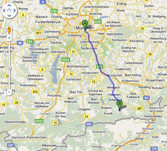
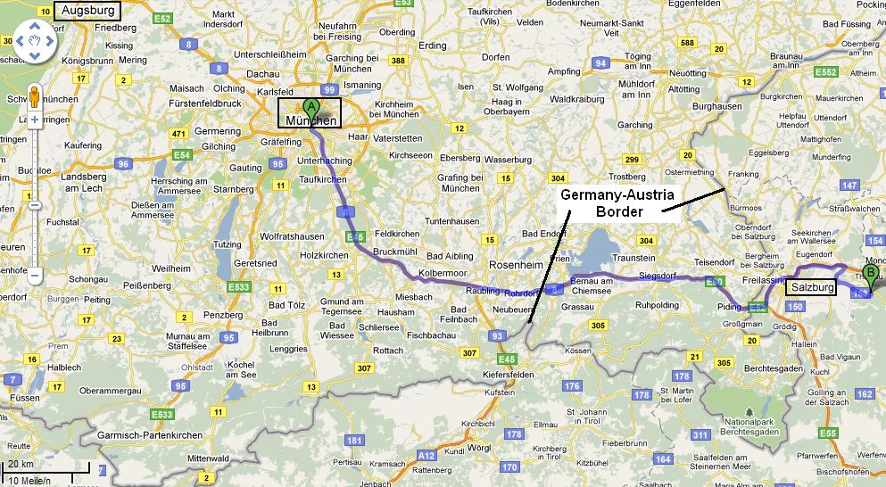
We decided the destination would be Salzburgerland - the state (and general area) around Salzburg, Austria.  It's quite close to Munich (about 90 minutes with clear traffic).


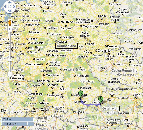
The border between the two countries winds and twists a lot - and in fact from Munich you can be in Austria within 1.5 hours heading either East or South!


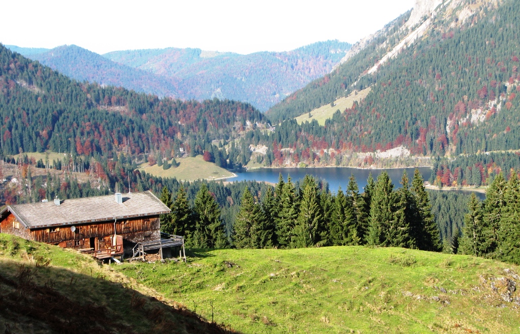
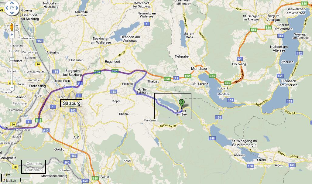
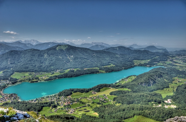
We continued past Salzburg into an area with many small Alpine lakes.  It's a very popular weekend and vacation spot because you can hike, bike, swim, and sail.  We ended in a town called Fuschl am See (Fuschl on the lake) -- the lake is called Fuschlsee, naturally.  Interesting fact:  Fuschl is the headquarters of Red Bull!


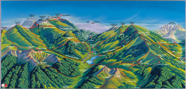
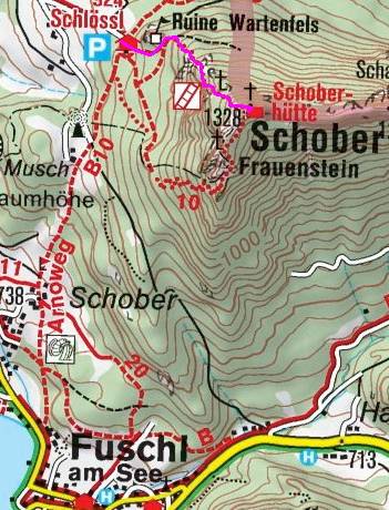
Near the southeastern corner of the lake is the trail head leading to two popular peaks:  the Frauenkopf and Schober.  The Frauenkopf is also called the Frauenstein (they mean "women's head" or "women's stone").  The trail (red dotted line on the map below) is numbered B10 by the Austrian Mountain Association and is rated "black" or difficult.  It departs north and then circles east to the two destinations, marked with crosses.  (I don't know what the third cross is for...)


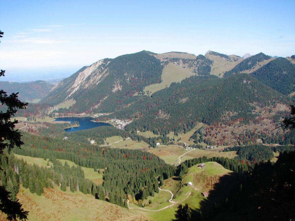
We decided to only climb to the top of the Frauenkopf rather than do the entire circle (we had something else planned in the afternoon).  Here was the starting point, below, at lake level.  At 9am, the weather was already sunny and warn, and the lake looked inviting (even more so after the hike).

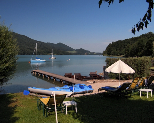
The lake lies at 924m above sea level, and the Frauenkopf sits at 1287m, so we the climb would be over 360m (1180 feet).  For those of us that didn't grow up in the mountains, mountains always look so far away from the valley floor.  "We're going up there?" said one of our guests!


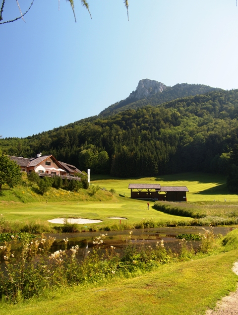
Did you notice the sand trap in the above photo?  Yes, Fuschl has a golf course, and the trail goes right through it.

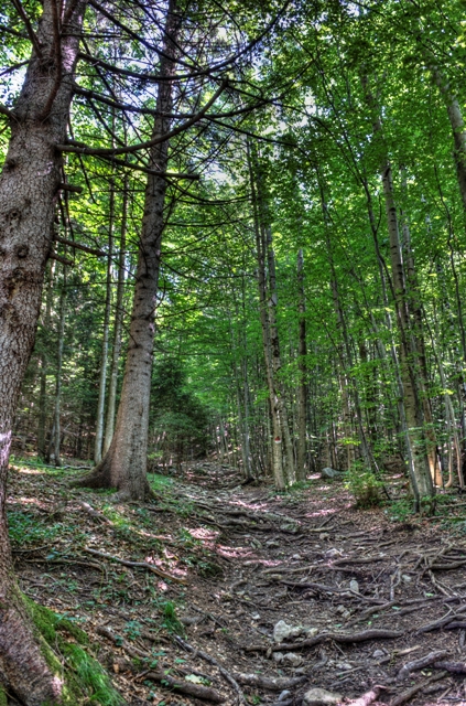
After walking through a field of wildflowers and past the golf course, we reach the woods.  The trees are beautiful, and really keep you out of the sun & cool while starting the tougher part of the trail.  The path itself has countless tree roots sticking up - don't turn an ankle.

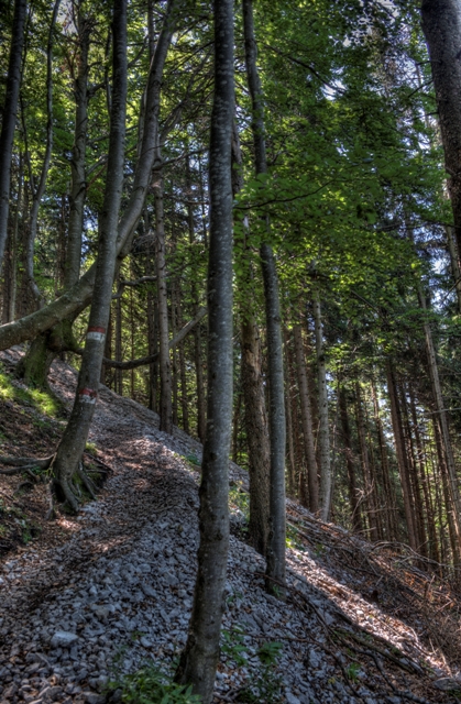
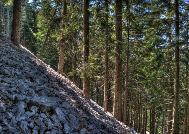
We then reached the fun part.... the trail starts snaking up the mountain steeply and is lined with gravel or rocks (in some places it's small rocks, in others gravel sized pebbles).  The Austrian Mountain Association keeps it tidy, though, with maintenance throughout the year.  Almost looks like they were dumped here...

You can see how steep the mountain is from this view - luckily the path is full of switchbacks rather than a walk straight up!

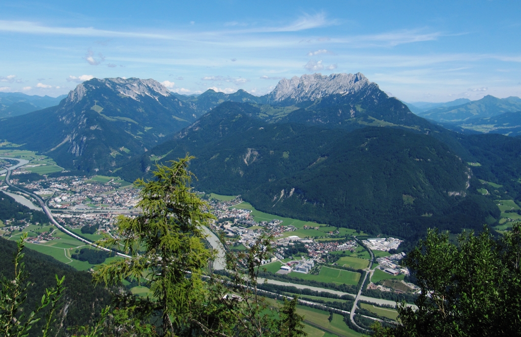
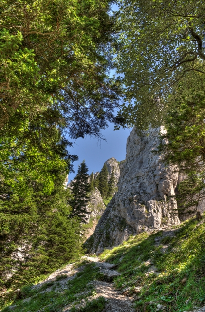
As we climbed higher, we solved the mystery of why (and how) the path was covered with rocks - they're actually natural slides from the material on the exposed peaks breaking off.  Between the steep slope and the sometimes slippery rocks, you have to go relatively slowly. Luckily there are some spectacular views along the way - you can start to see the top, which helps when you're getting tired!


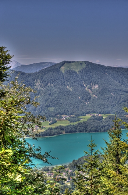
As we climb higher, we also get glimpses of the lake below.


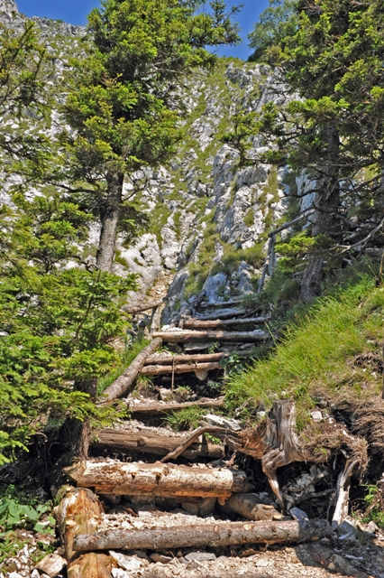
After a little stop for water and to enjoy the view, we start to head up the "summit". It starts with stairs that have been cut into the slope. These definitely help the ascent, though some of them are quite a tall step up!


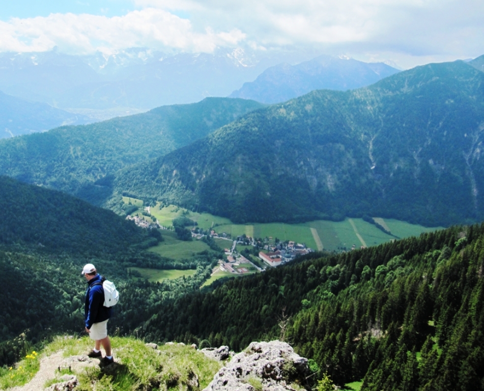
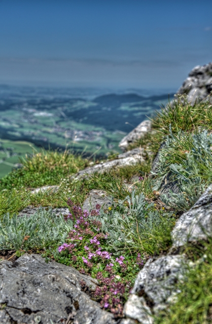
It's a little bit of a scramble to reach the last peak, but completely doable. We're rewarded with a gorgeous vista and a rocky ridge covered in scrubby little wildflowers.  (You can see the golf course down below)


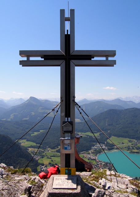
It always feels great to finally see the cross that adorns most peaks (even small ones like this).  This also has a plaque saying Frauenkopf, and a stamp that you can use to show you made it.  Frau A and I don't have a "book" but we can imagine locals having many dozens of stamps in theirs.


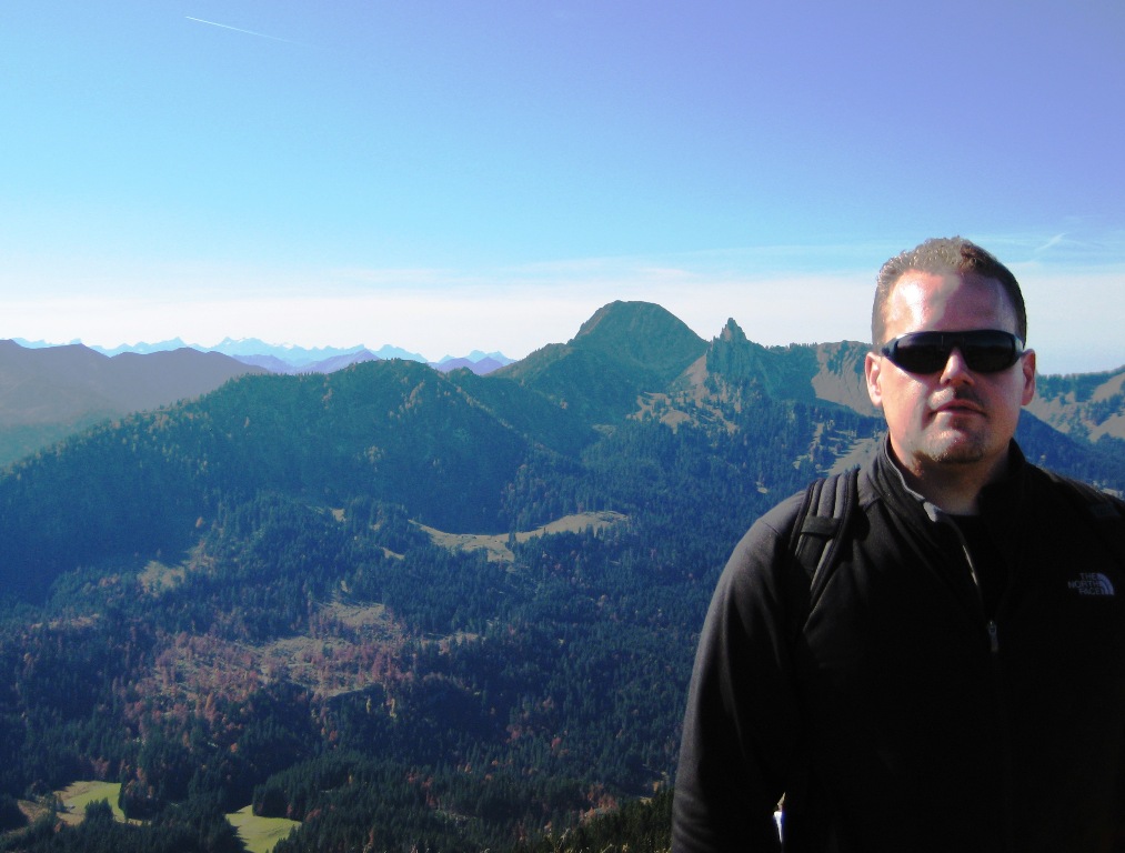
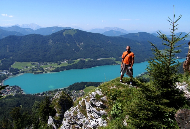
We got a nice photo of Mr. C enjoying the view (nothing like this in Dallas, huh?)...


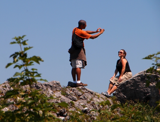
...and then himself capturing a picture of his lovely wife Mrs. M:

In the end, the linear distance there & back was about 6 1/2 km (a little over 4 miles).  It took us about 2 3/4 hours up, and 1 1/2 hours down.  The only hütte (Alpine hut) was at Schober, and we didn't go there, so there was no place to stop for refreshment on the way as usual!  Tired and hungry, we lunched at a local "wellness" hotel , and then headed on to the afternoon activity... to be posted soon...

It was great to see friends, and there's no better place than in the Alps on a beautiful day.

Next time we'll tackle the Schober (seen here from atop the Frauenkopf)!

Sunday
May152011

Munich Day Trip - Spitzingsee

Yet another nice one-day hike near Munich is to the Spitzingsee.  As usual, the day starts by driving south... but this time we stop short of the Austrian border and remain in southern Bavaria.  (And as usual, leaving early helps avoid traffic on the weekends, but the autobahn will be packed on the way back.  No way to avoid it.) 


I found a nice map of the lake and surrounding mountains (click on it for a full-size PDF) on a local tourist web site (German, sorry).  You can see the Schliersee in the middle, a small town at the foot of the lake on the left, and two ski-lifts flanking the lake on each side.  I've never been skiing here, but we're not in the "big" Alps yet so slopes will be gentle and short.  The lifts are also open in summer for hikers who want to take it easy, or those that stayed too long having beer at the huts(s) and need to get down quickly.


On this day I took the path that starts at the base of the Stümpflingbahn at the upper right corner of the lake in the map above.  In the morning, I took the path "up" from the lake going towards the Becksteinhaus ("north" on the map), then veered right ascending to the Roßkopf.  The first photo below is on the way to the top, looking back into the valley and lake.


I think the next photo is looking in the other direction, away from the lake this time, over the background peaks.  As usual, it's cool in the morning but with good sun you're soon in t-shirt only -- but bring the fleece in any event.  The lake itself sits at over 1000m elevation, but the surrounding summits max out at 1600m, so it's only a 600m difference.  The hike therefore takes maybe 4 hours round trip, depending on the duration of the pause at a hut for food and drink.  The paths are clearly marked here, almost impossible to get lost, and enough fellow hikers that there's always somebody else around just in case.


In the third photo, it's clear that we're in Autumn -- nice fall colors!  You can see on the hiking map that the path criss-crosses the ski lift a couple of times (from the Roßkopf, go down and then left).  You can see a lot of people on the lift, heading up to the Jagahütt'n.  I didn't get a picture there, but it's a pleasant view for lunch.  The colors of the leaves aren't quite as dramatic and beautiful as where I grew up (Western New York State) but they are nice!


In the final photo, I was just about back down to lake-level and this house came out of nowhere.  They're lucky to have this view!  Overall this area feels smaller and quieter than most Alpine towns that lure outdoorsmen (Wikipedia German says there are only 200 inhabitants).  And although the trails around Spitzingsee aren't the most challenging and might not appeal to thrill-seekers, they're even closer than the hiking options in Austria and are a great Munich day hike.


Saturday
Apr302011

Munich Day Trip - hiking in Kufstein (Austria)

We've previously blogged about our winter sledding day-trip to Kufstein in Austria.  It's close to Munich, has beautiful mountain views, and of course hiking up and sledding down.  Perfect for a Saturday or Sunday.

I will be taking Frau A back this summer too, because it only gets better.  Snow is nice, but now we'll get the classic fir trees and meadow flowers in the Tirolean Alps.  Pictured below, I'm looking back north onto the mountains of the Wilder Kaiser which are actually located in Germany.  The trail has a lot of nice viewpoints like this, looking down into the valley and small village below.  Shorts are fine for hiking here when the weather is good; I take a fleece for when the sun hides or wind comes up at altitude, and water in the backpack until we reach the hut.

Further along the path you get a more extended view of the valley, again the Wilder Kaiser in the distance, and a small river running through the town now.  I think this water eventually connects with the Isar on it's way to Munich.  As the sun burns off the morning haze the peaks get a little sharper in the distance.  Nice view. 


This time, before reaching a hut, we go up to a peak called the Pendling Gipfelkreuz (gipfel = peak and kreuz = cross).  Not a really high destination relative to most in the Alps, but feels great to be on top.  The fleece is off at this point - worked up a sweat on the last incline.  Even changed baseball hats!

Not far from the summit is the Pendlinghaus (also known as Kufsteiner Haus, see the yellow sign above the door), another typical hut that offers food and drink to hikers.  The sign in the foreground says "wilkommen" -- welcome.  Now if you look closely at the antenna on the house, you'll see a glider behind it!  The pilot was circling around for over a half-hour and would zoom past the house, so I was able to snap the photo just as he passed my field of view.  On the right, you can see the same valley as the previous photogtraph.  That's the view when you have lunch here.  And you can rent a room for overnight too!  But I didn't eat here, because I wanted to get back to the hut from our winter hike, the Kala Alm.

So I headed back toward the Kala Alm, where we rented the sleds in winter.  It was in the Spring, and some peaks still had their snowcap.  In this direction we are seeing the Tirolean Alps vs. the Wilder Kaiser range in the previous photos.  They are a little larger and more dramatic.

When you arrive at the Kala Alm, it looks basically the same this time, just no snow.  People outside having food and drink, enjoying the weather... but then you notice something.  They can't rent sleds without snow, but they can rent Mountaincarts!  There's a whole row of them on the right below.  (Actually, you can still see some residual snow too, the last remnants of winter up here.)

A mountain cart is like a Big Wheel for grown-ups.  German (Austrian?) engineered, they are not powered (gravity is all you need, and more) but the do have two hand brakes like on a bicycle.  The right brake works the right rear wheel, the left brake the left rear wheel.  Therefore, they're not just for reducing speed, but to help navigate the winding corners of the path down.  When you slightly brake a wheel, it rotates more slowly than the other wheel does, therefore your cart will turn in that direction.  Brake a little with the right, you will will get a little help turning right.  The best riders use this to literally "skid" through the corners.  It is so much fun.

The two photos above are taken from (and link to) a site with more Mountaincart information.  I was too busy having fun to take photos of my own.  However, Frau A and I will be back and try to take some video too! 

Thursday
Apr142011

Munich Day Trip - Pertisau / Achensee (Austria)

At my prior company, we had an annual weekend retreat in Pertisau, Austria.  It's really a classic destination for Germans and Austrians:  in the gorgeous Alps, lots of "Sporthotels" to stay in (focus on healthy/organic food, have a good spa, mountain bikes to rent, etc.), petting zoos and park playgrounds for the kids... colleagues brought their families along each year and it was a real highlight.

Pertisau is a bit more than 90 minutes from Munich, with good traffic.  (That's another future post - parts of the autobahn have no speed limit, but good luck taking adantage with the crowds.)  Like many trips near Munich, Pertisau is located in the Tirol section of Austria.  Tirol has 2 primary mountain ranges:  the Karwendel and the Rofan (also called the Brandenbergs).  They're the quintessential peaks for hiking in summer and skiing in winter.  In the area around Achensee (Lake Achen) they have over 200km of cross country skiing trails and over 500km of well-marked hiking trails!  Plus, they maintain 12 live webcams to try and temp you into a day trip or holiday.

Here is Pertisau on Google Maps:


Below is the hotel where my old company put us up for the weekend.   Nice, right?  Green Alpine meadow, gray limestone cliffs, and blue skies.  The rooms (no photo) are typically utilitarian, with modest size, hard beds, a tiny television (they expect you're not there to watch the tube), and usually a small balcony.  Most guests get up early for vacationers - tables are pretty full for breakfast by 6:30!  If the sun is up, they want to be outside.


Obviously my visits there were in the Summer, which means hiking.  The path we took climbs from about 1100m to 1400m and takes 1.5 hours one way.  It's graded as "easy" so you see a lot of families with children.  Along the way, we saw a group a cows that looked like they came right from a tourist brochure.  My colleague went over to say hello.  Notice also the tiny flowers.  It is such a stereotype, but the Alpine meadows are picturesque.

As you get higher and round the corner to see the lake again, the view gets good.  The Achensee water is especially colorful (it's mainly glacial runoff), and the peaks in the back are very close.  The hotel is sitting the tiny valley below.  Many folks prefer to hit the beaches along the lake or even sail, but over a week you could do something different every day.


One thing I did not (and never have) done is paragliding, but I saw a lot of paragliders here and caught this guy on camera.  You also notice a small lookout over the lake with people resting, watching the paragliders.  This is definitely on my shortlist -- they say the updrafts here are strong enough but not too unpredictable or violent.


The destination, as usual, was a hut (and a little higher for a nice view).  The "menu" is typically Austrian:  cold cuts and bread, goulash soup, wurst and potato salad, and of course water/beer/juices.  There are a lot of huts on the trails, but we stopped at the Dalfaz Alm (see photo below).

Dalfaz Alm, Achensee, Tirol


For kids, one of the highlights is pigs that the hut keeps.  Here is my co-worker again, this time interacting with the pigs - who are eagerly sharing his banana.


Speaking of animals, the other things I love to see is people hiking with their dogs.  A couple brought along their pair of Huskies.  The summer heat can be tough on them, but at altitude (even only 1500m) it's more pleasant for these guys.


Well, that's a brief view of the opportunities that Pertisau / Achensee provides.  Check it out, or look at other options for an Austrian getaway in any season.