Entries in hiking (19)

Sunday
Jan222012

Munich Day Trip - Hiking in Murnau

In late November, we attended a suprise party for a friend in Munich.  As part of the surprise, we used the pretense of hiking to get him and 3 sons out of the house while his wife and other son prepared for the party.

(I must admit here that we were an hour late getting him back, since he'd promised the boys we'd stop for ice cream and we didn't know how to hurry everyone along without ruining the surprise. Besides....ice cream!...)


Murnau lies just 70km from Munich (less than an hour), near Staffelsee. There are several Rundweg in the area (hikes where you can circle back to your starting point), ranging from the 4 and 5 km walks like the  Höhlmühle-Rundweg to the 20.5 km Staffelsee-Rundweg that circles the lake.  Most of these are not strenuous hikes nor have great changes in elevation, so they're good options for families with small children or for a day when you want a relaxing excursion into nature.

We chose the 5.9km Drachenstich-Rundweg,which offers a walk through Murnau, along the banks of the Staffelsee, across the Murnau Moor and down a small gorge. The circuit takes its name from the dragon that legend holds lived in the gorge and feasted on maidens.

You'll find many businesses in Murnau with the name Drachen (dragon) in them, and of course the local volleyball team is the Murnauer Drachen!

It's an area known for nature and art (Kandinsky's longtime partner, painter Gabriele Münter, lived there), and a beautiful trip to the lakes below the Alps.

You can see below where the Drachenstich-Rundweg breaks off from the longer walk around the lake:


It was a gorgeous fall day. Probably the last good day of fall or the first nice day of winter. But beautiful clear skies, lovely winter sun, and the last of the leaves falling from the trees.

And the first frost (for us, at least....I'm sure there was frost south of Munich earlier).


There are many lovely houses and hotels along the lake.

It's a great area for watersports. Though most of the boats and kayaks had been put away for winter, there were a few still out there enjoying the day.


And a couple of paddleboarders. That looks like a great way to travel to the islands! Though I'd be terrified of falling in the cold, cold water.

So, after a walk along the shore, we met the trail to the Drachenstich. It's a pretty leisurely walk through the tall, thin trees, with a gentle slope.

You then exit the woods to a field with several bluffs overlooking the lake to one side, and the main road and farmland to the other.

After crossing the road and the train tracks, we're now ready to enter the dragon's woods.

Though this isn't a steep hike or one at a high altitude, the views of the Alps across the fields are beautiful!

As with most popular trails in the area, it's incredibly well maintained.

We finally come to a steeper descent, down to the dragon's gorge. And a small waterfall, of which one of our hiking buddies scrambles up to the top.

I can't say enough how wonderful the light was!
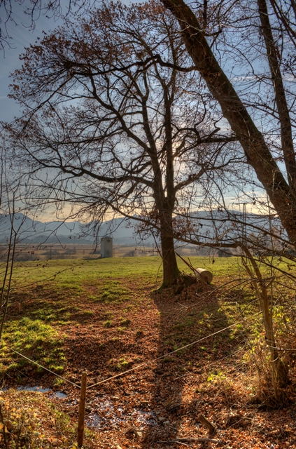
The guys paused to enjoy the sun and the view before heading back into town. 


We stop at the playground for a quick break.

But most importantly, ice cream!


After a few covert SMS's to our hostess to let her know the ETA, we finally make it back to find a wonderful feast and many friends.

They made great use of the covered pool in the backyard - using it as a party area!


A wonderful afternoon hike through the woods and fields, followed by a great night with friends!

Thursday
Aug042011

Munich Day Trip - Aying

Most of our previous 'Day Trip' blog posts, like this one to Kufstein, have a destination at least 1-2 hours away from Munich by car.  If you don't need a mountain fix in the Alps, there are options closer to the city that still feel like you're getting away.

One such destination is a walk from Aying -- it's a small town (population 4,500) with a station on the S-Bahn (commuter train).  It takes about 40 miniutes from the Ostbahnhof to get there on the S7 line.  The trains run every 20 minutes in each direction, during normal hours.


Aying is most well known for its brewery Ayinger... but that is something to visit after our walk.

After you get "out of town" (which just means walking down the main street -- that's basically all there is) the route will run in a circle, past Göggenhofen to Grosshelfendorf.  The return path goes through Heimatshofen and Graß (Grass) back to Aying.  All of the above are very small, and you walk through these villages in minutes. 

Here is a map (plus ascent/descent chart) I found on a German site:

As you can see in the chart above, there are no mountains here!  The complete circle takes about 2.5 hours to walk, depending on speed and stops of course.  And 9 of the 12 kilometers are on some kind of sidewalk or street ("asphalt"), while the rest simply uses the local farmers' tracks or wide forest path ("weg").

In an early stretch between Aying and Grosshelfendorf, the route goes off-road through light woods, and I caught it at the perfect time for a photo (this was in the Winter, obviously).


The primary destination of this walk is the Marterkapelle (Martyr's Chapel) of St. Emmeram in Kleinhelfendorf, marked on the map above with a cross.  This is what it looks like on approach across the farmer's field: 


As the story goes, the itenerant bishop St. Emmeram was martyred nearby in the year 652.  The Bavarians were "idolaters" at this time and he was trying to convert them, but I guess after 3 years the Duke of Bavaria had heard enough and had him killed.  The chapel has a large scene depicting the event in the middle of the church, almost entirely made of wood (see photos below). 


In the center of the display is the martyr's stone, where supposedly the saint died.  Pretty gruesome rendering of the martyrdom:


The ceiling shows biblical events and themes too, in the rococo (late Baroque) style.  Note that the original chapel was built in 1640, but was replaced in 1752 with the current structure -- renovations are probably what keep it looking clean, bright, and colorful. 


Kleinhelfendorf also has a larger Church of St. Emmeram, which is where Bayern Munich star and German National Team captain Philipp Lahm chose to get married.  The Miesbach stucco work is supposed to be some of the nicest in Bavaria.  It's fine for a second stop along the route -- the two are quite close (church left, chapel right).


If you don't have the time (or desire) to head into the Alps, something like this countryside walk around Aying is perfect for a relaxing weekend getaway.  Frau A and I will visit the brewery some time too...


Monday
Jul252011

"Globetrotter" Outdoor Sports Megastore

Frau A and I had noticed that a new outdoor-sports store had opened recently in Munich near the Isartor -- within walking distance from Marienplatz and also at an S-bahn station, so a very convienent location.  Last Saturday we checked it out.

The company is called Globetrotter, and they're based in Hamburg.  Their Munich megastore is 6,500 square meters across four floors, sells over 25,000 items from 700 manufacturers, has 100 employees, plus holds offices for the German Alpine Society, a travel agent (that specializes in outdoor / adventure trips), and a travel doctor (probably for pre-trip vaccinations and medicine).

And that's just the start.

The first thing that strikes you when entering the store?  Look down and you'll see water.  It's a 100-square meter kayak and canoe test basin!  If you look closely, you'll see water jets -- these can produce "countercurrents" so you can practice your stroke.  Not sure if they'll let you perform eskimo rolls, though.

We headed to the basement level to take a closer look.  One guy (on the right, below) was sitting in a kayak but didn't use the basin -- too bad!  Racks of canoes and inflatable boats are in the background, and you get a peek of camping equipment on the higher floors (e.g., mosquito net).

As usual in Germany, the equipment is high quality and expensive -- the 2-person kayak on the right (above) costs 1600 euro!  Below, this kid was happy just to sit in the kayak, but mom didn't take him onto the water.

On the other side of the basement level are hiking and climbing shoes.  They're presented on a wall 60 meters long!  The wall is filled with different types of rocks creating a cool, wavy pattern.

We walked into the shoe section, and noticed they have a small test area for your shoes!  (This reminded us of the baby stroller test track we saw in a home furnishings store.)  The contraption has small racks of different rock types, all at incline, so you can get a feel for shoes a bit better than just walking around.  Here is Frau A testing out her Hunter wellies (they've been invaluable with all this rain lately!).

As it turns out, this store has a lot of different testing areas -- shoes were just the beginning.  A few floors above is the "rain chamber" -- a rain and wind test room for apparel!  You can don waterproof boots, pants, jacket and hat, then enter a plexiglass-enclosed area with two buttons on the floor.  Hit them with your feet, and down comes rain and, from the front, a fan generates wind.  You'll know pretty quickly if the equipment keeps you warm and dry.

We were able to get a movie of this in action!  This lady doesn't hit the button hard enough at first, but then gets it right and a quite a shock.


In addition to the rain & wind test chamber, Globetrotter has an "altitude cold chamber".  This simulates conditions at about 3900m.  The air has less oxygen and the temperature is -10 degrees celsius!

One half of the test chamber is just a room with fur-covered ice blocks to sit on -- to check out if apparel is warm enough when you're at rest in ice and snow.  This boy is getting cold already -- hands in the pockets. 

This is a close-up photo of an ice block and the fan that blows cold air.  Most people did not spend a lot of time in here:

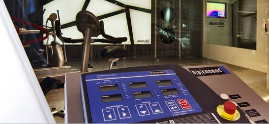
In another half of the chamber (pictured below) is a room with training equipment (e.g., treadmill and stairmaster).  The idea is to test apparel/equipment in a climate more like the real thing.  Jackets feel much different when you're huffing and puffing your way up a steep mountain trail:


On the top floor is a climbing area for children.

This tiny guy is getting assistance from dad, with additional safety padding under the feet.

Older children run up and try climbing on their own.

Of course, fun is not just for the kids.  The store also had a slackline set up.  I caught this guy as he lost his balance at the end.  Behind him are the yellow boxes of slacklines for sale --we've seen a number of people using these in the English Garden...

Frau A decided to try the slackline too.  After a few learning attempts, she got the hang of it.  (You can see the childrens' climbing area in the background -- not sure how many can actually hang from the "rocks" on the ceiling.)

There were loads of great products and equipment there, but the most humorous brought together the German outdoor and beer cultures -- the mini-keg backpack.  This army-green frame lets you hike with enough of your favorite brew for the whole group!

What a cool store.  It also offers seminars and training courses too, but it's tough to attend those with a job (many are during the day).  The gear selection and "test chambers" are really something -- I think a few Christmas gifts may come from this place...

Tuesday
Jul192011

Munich Day Trip - Fuschl and the Frauenkopf

In early July, friends of ours from Dallas came to visit!  We had to show them a good time, of course, so we rented a car and drove into the Alps for some early Saturday hiking.

We decided the destination would be Salzburgerland - the state (and general area) around Salzburg, Austria.  It's quite close to Munich (about 90 minutes with clear traffic).


The border between the two countries winds and twists a lot - and in fact from Munich you can be in Austria within 1.5 hours heading either East or South!


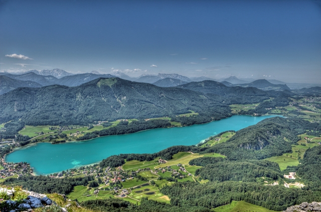
We continued past Salzburg into an area with many small Alpine lakes.  It's a very popular weekend and vacation spot because you can hike, bike, swim, and sail.  We ended in a town called Fuschl am See (Fuschl on the lake) -- the lake is called Fuschlsee, naturally.  Interesting fact:  Fuschl is the headquarters of Red Bull!


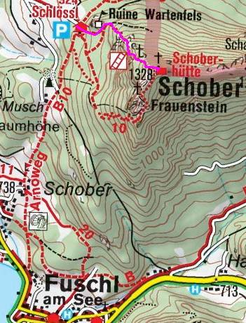
Near the southeastern corner of the lake is the trail head leading to two popular peaks:  the Frauenkopf and Schober.  The Frauenkopf is also called the Frauenstein (they mean "women's head" or "women's stone").  The trail (red dotted line on the map below) is numbered B10 by the Austrian Mountain Association and is rated "black" or difficult.  It departs north and then circles east to the two destinations, marked with crosses.  (I don't know what the third cross is for...)


We decided to only climb to the top of the Frauenkopf rather than do the entire circle (we had something else planned in the afternoon).  Here was the starting point, below, at lake level.  At 9am, the weather was already sunny and warn, and the lake looked inviting (even more so after the hike).

The lake lies at 924m above sea level, and the Frauenkopf sits at 1287m, so we the climb would be over 360m (1180 feet).  For those of us that didn't grow up in the mountains, mountains always look so far away from the valley floor.  "We're going up there?" said one of our guests!


Did you notice the sand trap in the above photo?  Yes, Fuschl has a golf course, and the trail goes right through it.

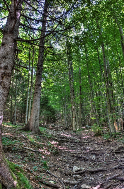
After walking through a field of wildflowers and past the golf course, we reach the woods.  The trees are beautiful, and really keep you out of the sun & cool while starting the tougher part of the trail.  The path itself has countless tree roots sticking up - don't turn an ankle.

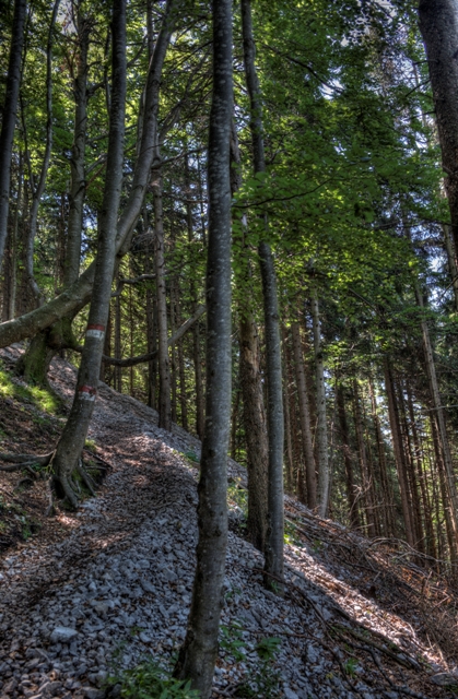
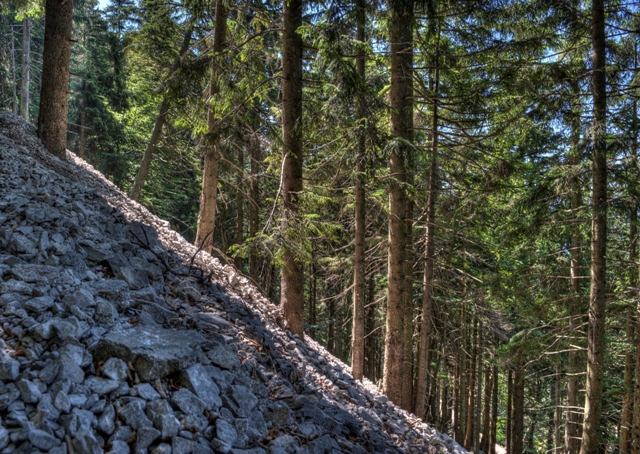
We then reached the fun part.... the trail starts snaking up the mountain steeply and is lined with gravel or rocks (in some places it's small rocks, in others gravel sized pebbles).  The Austrian Mountain Association keeps it tidy, though, with maintenance throughout the year.  Almost looks like they were dumped here...

You can see how steep the mountain is from this view - luckily the path is full of switchbacks rather than a walk straight up!

As we climbed higher, we solved the mystery of why (and how) the path was covered with rocks - they're actually natural slides from the material on the exposed peaks breaking off.  Between the steep slope and the sometimes slippery rocks, you have to go relatively slowly. Luckily there are some spectacular views along the way - you can start to see the top, which helps when you're getting tired!


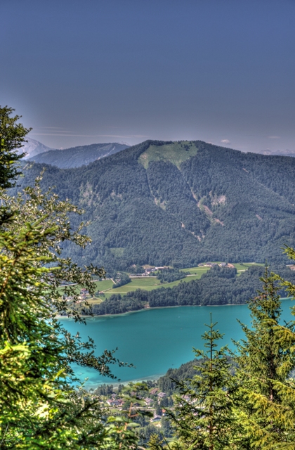
As we climb higher, we also get glimpses of the lake below.


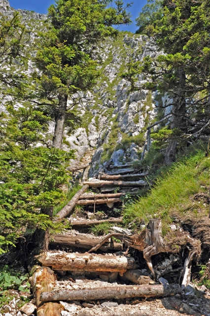
After a little stop for water and to enjoy the view, we start to head up the "summit". It starts with stairs that have been cut into the slope. These definitely help the ascent, though some of them are quite a tall step up!


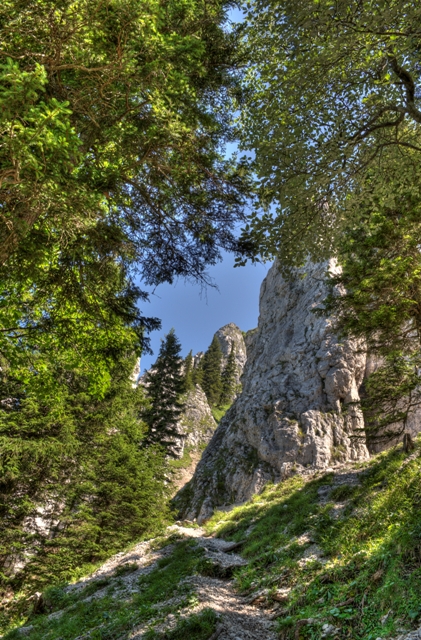
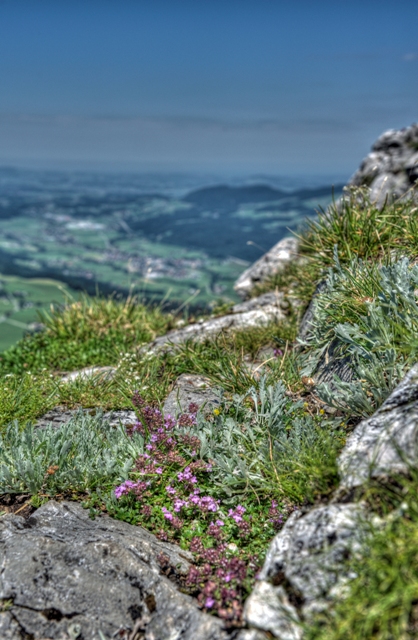
It's a little bit of a scramble to reach the last peak, but completely doable. We're rewarded with a gorgeous vista and a rocky ridge covered in scrubby little wildflowers.  (You can see the golf course down below)


It always feels great to finally see the cross that adorns most peaks (even small ones like this).  This also has a plaque saying Frauenkopf, and a stamp that you can use to show you made it.  Frau A and I don't have a "book" but we can imagine locals having many dozens of stamps in theirs.


We got a nice photo of Mr. C enjoying the view (nothing like this in Dallas, huh?)...


...and then himself capturing a picture of his lovely wife Mrs. M:

In the end, the linear distance there & back was about 6 1/2 km (a little over 4 miles).  It took us about 2 3/4 hours up, and 1 1/2 hours down.  The only hütte (Alpine hut) was at Schober, and we didn't go there, so there was no place to stop for refreshment on the way as usual!  Tired and hungry, we lunched at a local "wellness" hotel , and then headed on to the afternoon activity... to be posted soon...

It was great to see friends, and there's no better place than in the Alps on a beautiful day.

Next time we'll tackle the Schober (seen here from atop the Frauenkopf)!

Monday
Jul112011

Munich Day Trip - Hiking to Breitenstein (Bavarian Alps)

Last summer we joined a hike organized by the Munich chapter of Internations. This one was a short trip from Munich, to Breiteinstein in the Bavarian Alps. The drive took only an hour to reach the parking lot at the trailhead (in the village of Birkenstein, near Fischbachau).

You'll see in the Google Map below that Fischbachau lies east of Schliersee, near the Austrian border.

This is a good hike, with a mix of steep and easier stretches, as well as mixing meadows, forest, and rocky trails. 


The hike up takes around 2 1/2 hours and less than 2 hours down, depending on your stops. The trail begins around 850m elevation at Birkenstein, ascends to a hut at 1,585m, and finally to the peak at 1,622m (for a total rise of 1,170m).

You can see our destination below - we'll go all the way up to the small cross at the summit. 


The hike starts off with a steep walk up shady trails through the forest, before opening up into rolling meadows dotted with evergreens.  Not too bad, but definitely a challenge.


There are quite a few benches along the way to stop, rest, and enjoy the view. The wide trail then snakes through the meadows, with a steady (but not steep) climb upwards.


We then reach the bottom of a large grassy hill where cows graze, and gently wind around the hill into the forest on the right.


After passing through more shaded forest, we reach the Hubertushütte, a little hut serving drinks and snacks in a small valley below the peak of Breitenstein.  We stopped here for a snack before the final push up a rock-studded grassy hill up to the cross at Breitenstein. It's only another 10-15 minutes up to the peak.


Despite the not so steep-looking grassy meadow, the mountain drops off on the other side. At the top there is space to sit and look out over the villages in the valley, as this couple does. 


We ate lunch at the top, before heading down. Instead of the same route down, we passed along the ridge through a flat meadow where the cows grazed.


We pause to enjoy the view before descending.


Then back down the grassy hills. Herr J greets another one of our huge bovine friends. The cows were definitely one of my favorite parts of the day. 


Once again we had nice weather, friendly hiking companions, and great scenery (with animals!) -- this is why hiking in the Alps is so much fun.

Sunday
May152011

Munich Day Trip - Spitzingsee

Yet another nice one-day hike near Munich is to the Spitzingsee.  As usual, the day starts by driving south... but this time we stop short of the Austrian border and remain in southern Bavaria.  (And as usual, leaving early helps avoid traffic on the weekends, but the autobahn will be packed on the way back.  No way to avoid it.) 


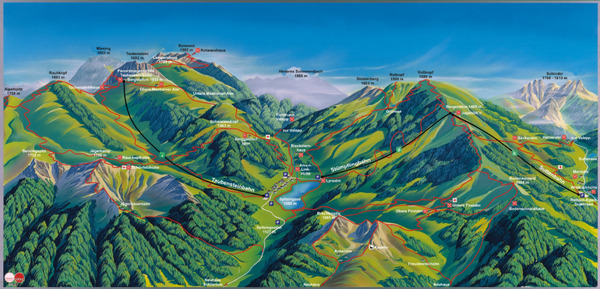
I found a nice map of the lake and surrounding mountains (click on it for a full-size PDF) on a local tourist web site (German, sorry).  You can see the Schliersee in the middle, a small town at the foot of the lake on the left, and two ski-lifts flanking the lake on each side.  I've never been skiing here, but we're not in the "big" Alps yet so slopes will be gentle and short.  The lifts are also open in summer for hikers who want to take it easy, or those that stayed too long having beer at the huts(s) and need to get down quickly.


On this day I took the path that starts at the base of the Stümpflingbahn at the upper right corner of the lake in the map above.  In the morning, I took the path "up" from the lake going towards the Becksteinhaus ("north" on the map), then veered right ascending to the Roßkopf.  The first photo below is on the way to the top, looking back into the valley and lake.


I think the next photo is looking in the other direction, away from the lake this time, over the background peaks.  As usual, it's cool in the morning but with good sun you're soon in t-shirt only -- but bring the fleece in any event.  The lake itself sits at over 1000m elevation, but the surrounding summits max out at 1600m, so it's only a 600m difference.  The hike therefore takes maybe 4 hours round trip, depending on the duration of the pause at a hut for food and drink.  The paths are clearly marked here, almost impossible to get lost, and enough fellow hikers that there's always somebody else around just in case.


In the third photo, it's clear that we're in Autumn -- nice fall colors!  You can see on the hiking map that the path criss-crosses the ski lift a couple of times (from the Roßkopf, go down and then left).  You can see a lot of people on the lift, heading up to the Jagahütt'n.  I didn't get a picture there, but it's a pleasant view for lunch.  The colors of the leaves aren't quite as dramatic and beautiful as where I grew up (Western New York State) but they are nice!


In the final photo, I was just about back down to lake-level and this house came out of nowhere.  They're lucky to have this view!  Overall this area feels smaller and quieter than most Alpine towns that lure outdoorsmen (Wikipedia German says there are only 200 inhabitants).  And although the trails around Spitzingsee aren't the most challenging and might not appeal to thrill-seekers, they're even closer than the hiking options in Austria and are a great Munich day hike.


Saturday
Apr302011

Munich Day Trip - hiking in Kufstein (Austria)

We've previously blogged about our winter sledding day-trip to Kufstein in Austria.  It's close to Munich, has beautiful mountain views, and of course hiking up and sledding down.  Perfect for a Saturday or Sunday.

I will be taking Frau A back this summer too, because it only gets better.  Snow is nice, but now we'll get the classic fir trees and meadow flowers in the Tirolean Alps.  Pictured below, I'm looking back north onto the mountains of the Wilder Kaiser which are actually located in Germany.  The trail has a lot of nice viewpoints like this, looking down into the valley and small village below.  Shorts are fine for hiking here when the weather is good; I take a fleece for when the sun hides or wind comes up at altitude, and water in the backpack until we reach the hut.

Further along the path you get a more extended view of the valley, again the Wilder Kaiser in the distance, and a small river running through the town now.  I think this water eventually connects with the Isar on it's way to Munich.  As the sun burns off the morning haze the peaks get a little sharper in the distance.  Nice view. 


This time, before reaching a hut, we go up to a peak called the Pendling Gipfelkreuz (gipfel = peak and kreuz = cross).  Not a really high destination relative to most in the Alps, but feels great to be on top.  The fleece is off at this point - worked up a sweat on the last incline.  Even changed baseball hats!

Not far from the summit is the Pendlinghaus (also known as Kufsteiner Haus, see the yellow sign above the door), another typical hut that offers food and drink to hikers.  The sign in the foreground says "wilkommen" -- welcome.  Now if you look closely at the antenna on the house, you'll see a glider behind it!  The pilot was circling around for over a half-hour and would zoom past the house, so I was able to snap the photo just as he passed my field of view.  On the right, you can see the same valley as the previous photogtraph.  That's the view when you have lunch here.  And you can rent a room for overnight too!  But I didn't eat here, because I wanted to get back to the hut from our winter hike, the Kala Alm.

So I headed back toward the Kala Alm, where we rented the sleds in winter.  It was in the Spring, and some peaks still had their snowcap.  In this direction we are seeing the Tirolean Alps vs. the Wilder Kaiser range in the previous photos.  They are a little larger and more dramatic.

When you arrive at the Kala Alm, it looks basically the same this time, just no snow.  People outside having food and drink, enjoying the weather... but then you notice something.  They can't rent sleds without snow, but they can rent Mountaincarts!  There's a whole row of them on the right below.  (Actually, you can still see some residual snow too, the last remnants of winter up here.)

A mountain cart is like a Big Wheel for grown-ups.  German (Austrian?) engineered, they are not powered (gravity is all you need, and more) but the do have two hand brakes like on a bicycle.  The right brake works the right rear wheel, the left brake the left rear wheel.  Therefore, they're not just for reducing speed, but to help navigate the winding corners of the path down.  When you slightly brake a wheel, it rotates more slowly than the other wheel does, therefore your cart will turn in that direction.  Brake a little with the right, you will will get a little help turning right.  The best riders use this to literally "skid" through the corners.  It is so much fun.

The two photos above are taken from (and link to) a site with more Mountaincart information.  I was too busy having fun to take photos of my own.  However, Frau A and I will be back and try to take some video too!